
Charleston, South Carolina, is a city renowned for its historic charm, vibrant culture, and picturesque landscapes. While the city itself offers a myriad of free attractions and activities, outdoor enthusiasts will find themselves particularly enamored with the abundance of hiking trails and natural wonders that surround this coastal gem.
From scenic marshlands to historic plantations, Charleston and its neighboring areas boast a diverse array of hiking opportunities suitable for adventurers of all levels.
Here is a map of all the hiking spots in Charleston that I have included in the post.
There are 2 trails you can camp on in Charleston South Carolina, including the Palmetto trail and the trails on James Island. You may need to pay for permits or admission fees
1. Pitt Street Bridge/ Mount Pleasant

Located in the charming town of Mount Pleasant, just a short drive from downtown Charleston, the Pitt Street Bridge offers stunning views of the surrounding marshlands and the shimmering waters of the Charleston Harbor.
If you are lucky, you may spot some dolphins!
Once a bustling thoroughfare, the bridge is now a pedestrian-only hiking path dotted with benches, making it an ideal spot for a leisurely stroll or a peaceful sunset hike in Charleston South Carolina.
Length: 1/2 mile round trip
Ease: Very Easy
Starting Location: 972 Pitt St, Mt Pleasant, SC 29464
Views: Ocean inlet, bridge, marshlands, dolphins.
2. Audubon Swamp Gardens
Nestled within the lush grounds of Magnolia Plantation and Gardens, the Audubon Swamp Gardens beckon nature lovers with 66 acres of enchanting boardwalks for hiking and diverse wildlife.
Visitors can wander through ancient cypress trees, spotting alligators, turtles, and a variety of bird species along the way.
Check Here for admission prices.
Length: 6 total miles (there are different trails you can take within the garden)
Ease: Easy
Starting Location: 3550 Magnolia Plantation Rd, Charleston, SC 29414
Views: boardwalks, animals, birds, various plants, swamps
Cost of Admission: $35 per person
3. Caw Caw County Park
Spanning over 600 acres of tidal cypress swamp and freshwater marsh, Caw Caw County Park is a nature lover’s paradise teeming with biodiversity.
Hikers can explore a network of trails (Check out the map of Caw Caw Country Park here) that wind through dense forests, open fields, and scenic overlooks, providing ample opportunities for birdwatching and wildlife observation.
Length: Total of 6 miles, with some trails being shorter
Ease: Depending on the trail, anywhere from easy to moderate
Starting Location: 5200 Savannah Hwy, Ravenel, SC 29470
Views: Exhibits, boardwalks, rare wildlife, rice fields, marsh
Cost of Admission: $2 per person
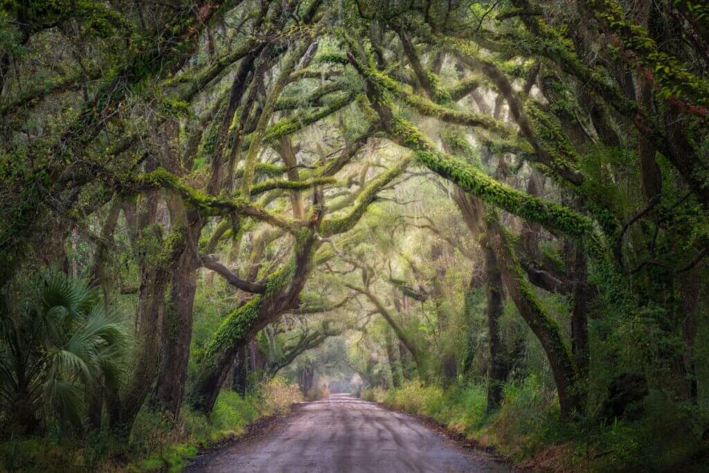
4. The Palmetto Trail
Stretching over 500 miles across South Carolina, the Palmetto Trail offers hikers the chance to explore some of the state’s most scenic landscapes. This makes the Palmetto Trail Charleston’s Longest hiking trail.
From the coastal plains to the foothills of the Blue Ridge Mountains, this long-distance trail presents a variety of hiking levels from easy to difficult.
If you don’t want to hike the entire 500 miles ( I wouldn’t want to!) you can start or finish at any of these trailheads in Charleston:
- Palmetto Trail Head
- Awendaw Passage
- PT Crossing
- Swamp Fox Passage (This is the longest section of the entire trail stretching across 47 miles of land)
Length: 500 Miles (Shorter lengths are sectioned off)
Ease: Easy to Hard
Starting Location:
Views: Depends on the area you are hiking in
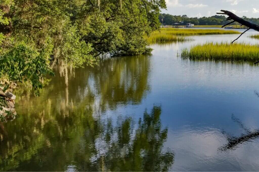
5. Edisto Nature Trail
Situated on Edisto Island, just a short drive from Charleston, the Edisto Nature Trail offers a peaceful retreat into the heart of the Lowcountry.
This scenic trail meanders through maritime forests, salt marshes, and along the shores of the Edisto River, providing hikers with glimpses of coastal wildlife and pristine landscapes.
Length: .7 miles round trip
Ease: Easy
Starting Location: 17038 Ace Basin Pkwy, Round O, SC 29474
Views: Marsh, wildlife, river
Admission: free
6. West Ashley Greenway
Spanning nearly 15 miles through the heart of West Ashley, the West Ashley Greenway offers a serene escape from the hustle and bustle of urban life.
This multi-use trail winds along a former railway corridor, passing through wooded areas, wetlands, and suburban neighborhoods, making it a popular destination for walkers, joggers, and cyclists alike.
You will find this trail to be perfect for strollers, bikers, walkers, and runners alike because of its paved pathway. There may be about 2 miles of it that is not paved.
Length: 15.7 miles out and back
Ease: Easy
Starting Location: Charleston, SC
Views: wooded areas, wetlands, and suburban neighborhoods
Admission: Free
7. James Island County Perimeter Trail
Encircling the entirety of James Island County Park, the Perimeter Trail offers hikers a scenic journey through diverse ecosystems, including forests, wetlands, and freshwater lakes.
With its well-maintained pathways and abundant wildlife, this trail provides an immersive outdoor experience for nature enthusiasts of all ages.
You can cool off when you are done hiking here at the splash zone or the spray play areas.
Download the PDF of the James Island County Park Map here.
Length: There are three different trails offering three different lengths:
- 1.2 miles circles the lake, river, and dog park
- 1.4 miles circles the shelters, playground, and spray play area
- 1.6 miles circles the campground, Edisto Hall, and goes along a short river
Ease: Depends on the trail, easy to moderate
Starting Location: 871 Riverland Dr, Charleston, SC 29412
Views: Parks, lake, river, campground, play fountain, shelters, and cabins
Admission: For entrance to the park it’s $2
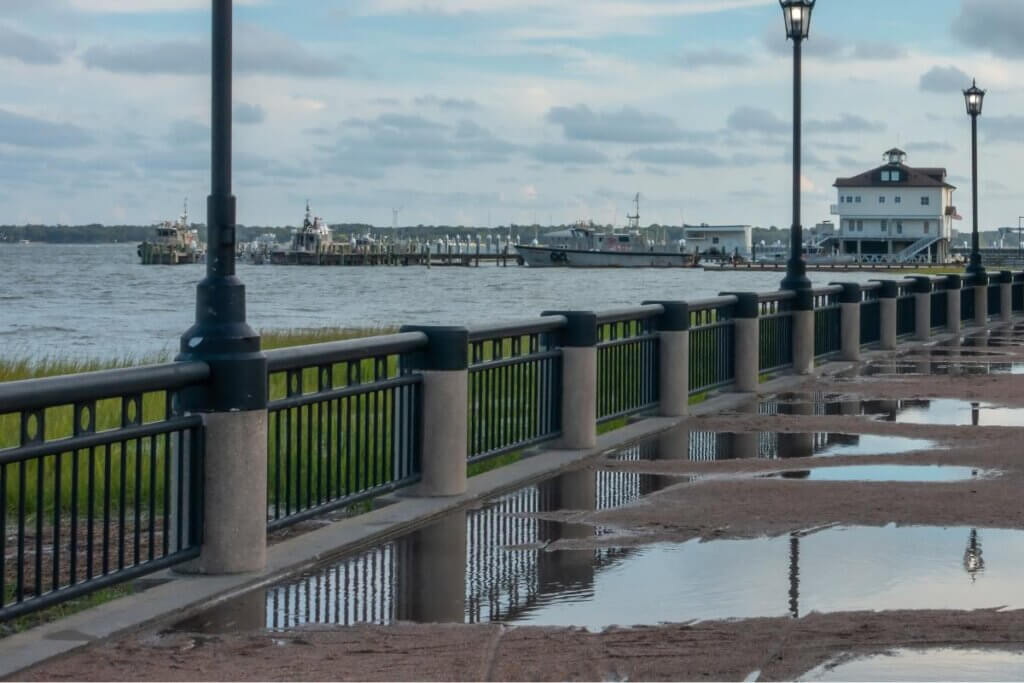
8. Low Battery Trail
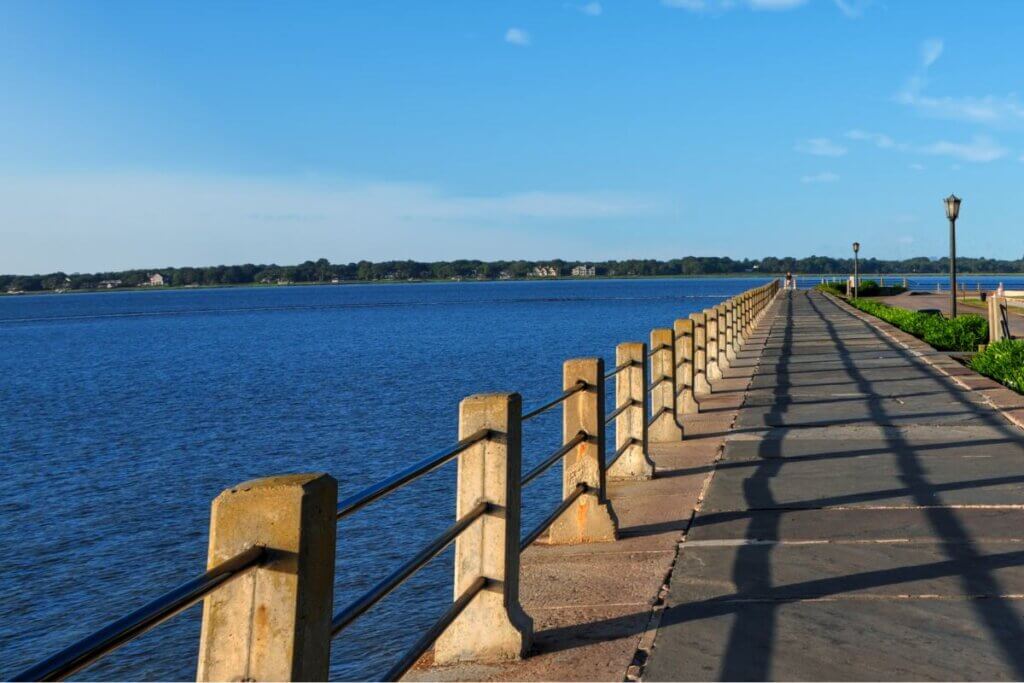
Running along the historic seawall promenade in downtown Charleston, the Low Battery Trail offers panoramic views of the Charleston Harbor and the iconic Rainbow Row.
As you stroll along this 2-mile picturesque pathway, you’ll encounter historic landmarks, majestic oak trees, and perhaps even a passing sailboat or two.
Length: 2 miles out and back
Ease: Easy (paved pathway)
Starting Location: 94 Murray Blvd, Charleston, SC 29401
Views: The inlet, battery, city
Admission Fee: Free
9. Waterfront Park Loop Trail in Charleston
Located in the heart of Charleston’s historic district, Waterfront Park is a beloved green space that offers stunning views of the Cooper River, the famous Pineapple Fountain, and the Arthur Ravenel Jr. Bridge.
The park’s scenic loop trail winds through lush gardens, scenic overlooks, and iconic landmarks, making it a popular destination for both locals and visitors alike.
Length: .5 miles
Ease: Easy
Starting Location: Vendue Range, Concord St, Charleston, SC 29401
Views: Pineapple Fountain, Cooper River, Arthur Ravenel Jr. Bridge
Admission Fee: Free
10. Charles Towne Landing State Historic Site Trail
Step back in time at Charles Towne Landing State Historic Site, where the first permanent European settlement in South Carolina was established in 1670.
The park features miles of hiking trails in Charleston South Carolina that wind through pristine woodlands, alongside scenic marshes, and past historic replicas, providing hikers with a unique blend of natural beauty and colonial history.
Length: 6 miles total with a 2-mile loop trail
Ease: Easy
Starting Location: 1500 Old Towne Rd, Charleston, SC 29407
Views: Gardens, historic exhibits, settlement sites, Lowcountry scenery, zoo animal forest
Admission Fee: $12 per person
11. Wannamaker County Park Trails in Charleston SC
Tucked away in North Charleston, Wannamaker County Park boasts over 1,000 acres of natural beauty, including miles of hiking and biking trails.
The park’s scenic loop trail meanders through pine forests, along freshwater lakes, and past serene wetlands, offering hikers a tranquil escape into nature.
Length: 15 miles total with the following loop trails
- 2.2-miles
- 8 miles
- 5.75 miles
- 1.75 miles
- 5 miles
Ease: easy to moderate
Starting Location:
- There are two types of trail systems for shorter and paved options go to 8888 University Blvd, North Charleston, SC 29406
- For more strenuous hiking in Charleston and biking go to 455 Westview Blvd, Goose Creek, SC 29445
Views: wetlands, pine forest, lakes, kids park and splash pad
Admission Fee: $2 per person if going to 8888 University Blvd
12. Hampton Park Charleston Hiking Trail
Located in the heart of Charleston’s historic district, Hampton Park is a picturesque hiking area and renowned for its lush gardens, scenic ponds, and historic monuments.
The park’s network of trails provides visitors with the perfect opportunity to explore its verdant landscapes and soak in the beauty of this urban oasis.
Length: .4 miles
Ease: Easy/ paved pathway
Starting Location:
Views: 30 Mary Murray Dr, Charleston, SC 29403
Admission Price: Free
13. Patriots Point Loop Hiking Trail Near Charleston
Situated on the scenic waterfront of Mount Pleasant, Patriots Point offers hikers panoramic views of the Charleston Harbor and the USS Yorktown aircraft carrier.
The loop trail winds through maritime forests and along the water’s edge, providing visitors with a scenic and educational outdoor experience.
Length: 2.7 miles round trip
Ease: Easy/ Paved path
Starting Location: Mt Pleasant, SC 29464
Views: Charleston Harbor, USS Yorktown aircraft carrier, forests, monuments, historic displays
Admission Price: Free
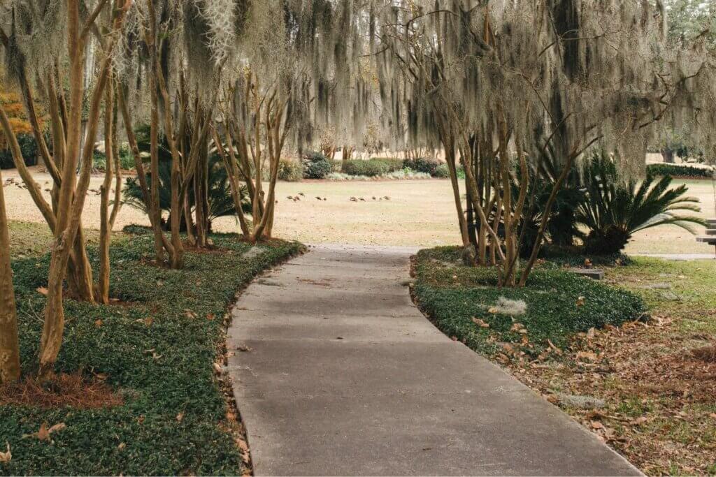
14. Francis Beidler Forest
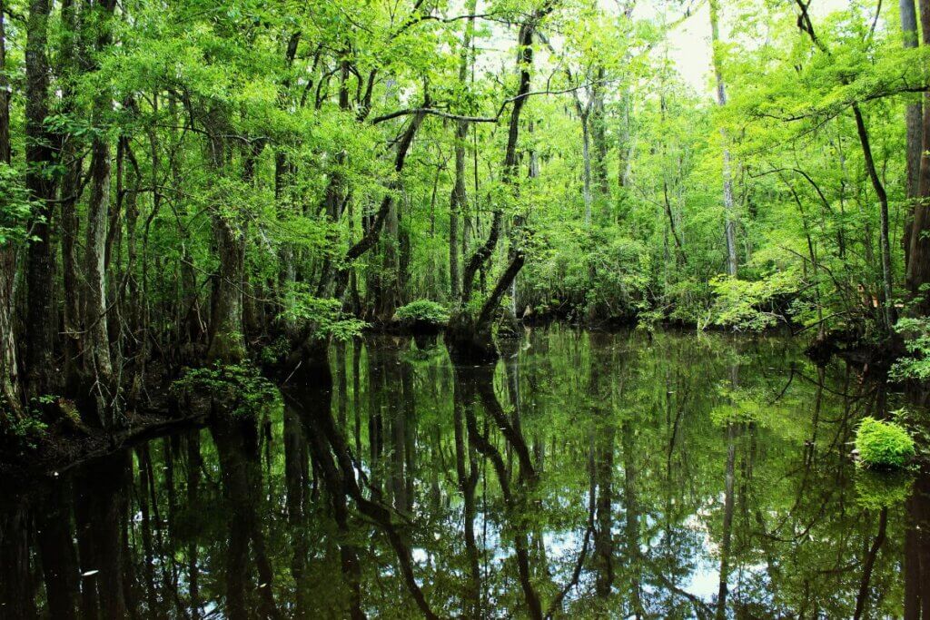
Venture beyond the city limits to explore the enchanting wilderness of Francis Beidler Forest, home to one of the largest remaining stands of old-growth cypress-tupelo swamp in the world.
Hikers can wander along elevated boardwalks that wind through ancient trees, providing a rare glimpse into South Carolina’s natural heritage.
You have two hiking options to choose from:
- Boardwalk Trail– 1.75 miles on a boardwalk above and around ancient trees and marshlands
- Grassland-Woodland Trail- unknown how long this trail is ( this section is free to the public)
Length: 1.75 miles or more
Ease: Easy to moderate
Starting Location: 336 Sanctuary Rd #3324, Harleyville, SC 29448
Views: Boardwalk, grasslands, ancient trees, wildlife, rare birds
Admission Fee: $12 per person
15. Botany Bay Plantation Trails Near Charleston

Located on Edisto Island, Botany Bay Plantation Heritage Preserve and Wildlife Management Area is a coastal treasure teeming with natural beauty and historic ruins.
The preserve features miles of hiking trails that lead through maritime forests, along sandy beaches, and past centuries-old structures, offering visitors a glimpse into the area’s rich cultural and natural history.
Want to visit Edisto Island? Check out our following posts:
- Best Places to Eat on Edisto Island
- Best Beaches to Visit on Edisto Island
- Best Places to Stay on Edisto Island
- Adventurous Things to Do On Edisto Island
Length: 1.8 miles out and back
Ease: Easy
Starting Location: Botany Bay Rd, Edisto Island, SC 29438
Views: Beach, driftwood, boardwalk, historic ruins, marsh
Admission Fee: Free, however, you will need to acquire a free day pass from the kiosk before entering.
16. Marrington Plantation Bike Trail
Located in Goose Creek, just a short drive from Charleston, Marrington Plantation offers cyclists and hikers a network of scenic trails that wind through pine forests, alongside tranquil ponds, and past historic landmarks.
With its diverse terrain and peaceful ambiance, Marrington Plantation is a hidden gem for outdoor enthusiasts.
The park is for both civilians and military. However, if you are a civilian you will need to obtain a pass to get in.
To obtain a pass you could spend around $10 for an application fee, and it could take up to 6 weeks to finish processing the background check (be sure to handle this ahead of visiting.) Check out the Outdoor Adventure Center for passes.
Length: 20 miles total
Ease: Easy to difficult
Starting Location: Goose Creek, SC 29445
Views: biking, hiking, and running paths through the forest
17. Bulls Island

Accessible only by ferry, Bulls Island is a pristine barrier island located within the Cape Romain National Wildlife Refuge.
Hikers can explore miles of undeveloped beaches, maritime forests, and tidal marshes, encountering a wealth of wildlife along the way, including shorebirds, dolphins, and even the occasional alligator.
Length: ?
Ease: Easy
Starting Location: Sheep Head Ridge Rd, Awendaw, SC 29429
Views: Beach, ocean, marsh, wildlife, alligators, driftwood
Admission fee: Must acquire ferry tickets to get to the island. Adult: $55 Children: $35
18. Cypress Gardens

Immerse yourself in the serene beauty of Cypress Gardens, where ancient cypress trees, lush gardens, and tranquil waterways create a captivating natural oasis about 33 minutes away from Charleston.
The park features a network of trails that wind through wetlands, alongside blackwater swamps, and past historic landmarks, providing visitors with an unforgettable outdoor experience. You can also visit in person, the boat scene from The Notebook!!
Check the website For a PDF of the grounds map.
Length: Outer loop = 2.4 miles
Ease: Easy-medium
Starting Location: 3030 Cypress Gardens Rd, Moncks Corner, SC 29461
Views: Cypress trees, the scene from The Notebook, wildlife, rice fields, waterways
Admission Fee: $10 for admission/ includes a boat tour
19. Hiking the Ravenel Bridge in Charleston

For those seeking a unique hiking experience with breathtaking views, a trek across the Arthur Ravenel Jr. Bridge is a must-do activity in Charleston.
Spanning the Cooper River, this iconic bridge offers panoramic vistas of the city skyline, the harbor, and the surrounding Lowcountry landscape, making it a popular spot for walkers, runners, and cyclists alike.
Length: 2.5 miles out and back
Ease: Medium
Starting Location: The best place to park is Mount Pleasant Memorial Waterfront Park Parking and start your walk from there.
Views: Ravenel Bridge, Cooper River
Admission Fee: Free
20. Laurel Hill County Park
Nestled along the banks of the Ashley River, Laurel Hill County Park offers hikers a peaceful retreat into nature just minutes from downtown Charleston.
The park’s scenic trails wind through wooded areas, alongside tidal creeks, and past historic ruins, providing visitors with a serene escape from the hustle and bustle of city life.
Here is the PDF of the trail map.
Length: About 1 to 4.4 miles out and back (depending on which path you decide to take)
Ease: Easy
Starting Location: 1251 Park W Blvd, Mt Pleasant, SC 29466
Views: Wildlife, woods, biking trails, large open meadows, small lake, overlooks
Admission Fee: Free
21. Morris Lighthouse
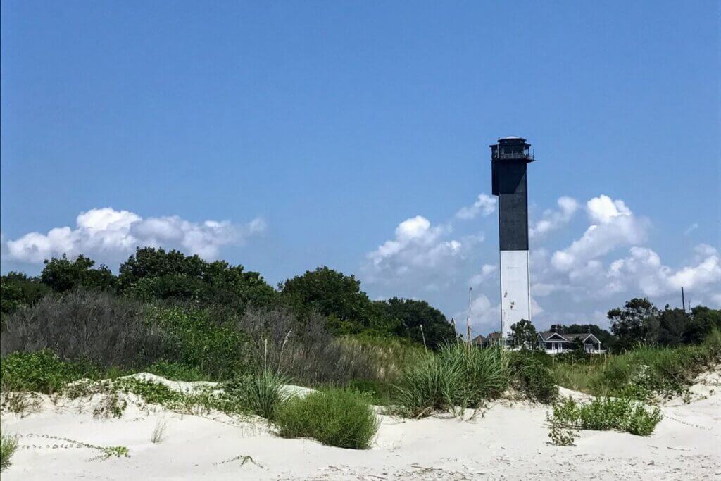
Morris Lighthouse will always hold a special place in my heart! It is truly magical and scenic especially when you go during sunset.
You will not get close to the lighthouse on foot because the Morris Lighthouse is in the middle of an inlet. You will have to walk along E. Ashley Avenue. You will follow the graffiti road which turns into a sandy path. You will run into a beach area and see the lighthouse after the sandy path ends.
P.S. I would park on E. Ashley Avenue near the Beach Access Summer Place. Please don’t park in anyone’s driveway or in the way. You can park along the road. Bring some hefty bug spray, the dear flies WILL bite as they are overpopulating in the area.
Also, be aware that there is a nudist beach nearby, so if you don’t want to see all that, stick to the graffiti path!
Length: About a mile
Ease: Easy
Starting Location: E. Ashley Avenue near Beach Access Summer Place on Folly Island
Views: Beach, graffiti, woods, sand dune, ocean, lighthouse
In Conclusion
From scenic waterfront promenades to remote barrier islands, Charleston and its surrounding areas offer a wealth of hiking opportunities for outdoor enthusiasts of all interests and skill levels.
Whether you’re seeking a leisurely stroll through historic gardens or an adventurous trek through pristine wilderness, the Lowcountry has something to offer everyone.
