
Sunset Crater Volcano Visitor center
Disclosure: Some of the links in this post are ‘affiliate links’. This means if you click on the link and purchase the item, I will receive an affiliate commission.
Yes, this area is still open. Always make sure you check with places before you go, as there have been many closures due to Covid.
You don’t want to miss out on some of Arizona’s volcano sightseeing. Some of them you can even hike to the top of.
Just off of Highway 89 there is a loop road that will take you through the Sun Set National Park with some of these volcanos. Also, This loop road will give you an opportunity to view the following…
- O’Leary and Bonito Camp Grounds
- O’Leary Peak Trailhead and Lookout
- Sunset Crater Volcano Visitor Center
- A’A Trailhead
- Lava Flow Trailhead
- Wupatki National Monument
- Cinder Hills
There is a Vehicle fee of $25 unless your visit falls on the days listed at the National Park Service website (then it will be free). Those fees will be paid at a toll booth before you enter the national park.
Camp Grounds
There are two areas where you can camp, and both are located at the beginning of the park entrance.
The O’Leary campground is designed for bigger group camps and sits below O’Leary Peak. It is over $100 per night, but that depends on the spot you want and how many are in your party.
The Bonito Camp Ground is located a short drive after the O’Leary Camp Ground. It costs about $26 per night, and you can stay up to 14 nights.
These areas are open now after Covid. Check on the website, because these camps may be closed due to fire danger in the area.
1. O’Leary Peak trailhead and lookout

To my understanding, you will not have to pay the $25 fee in order to hike the O’leary peak trail. Let the park ranger at the booth know you plan on only hiking this trail, and they should let you by without the fee.
O’Leary Peak trailhead is 3.5 miles to the tower (you actually cannot access this tower). You don’t necessarily need the tower to see the views of Humphreys Peak, Sunset Crater, and the rest of the San Francisco Peaks. The hike is considered moderate and lightly trafficked.
2. A’A Trailhead
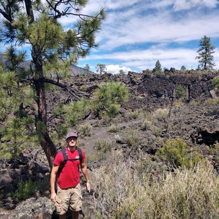
The A’A trail is an easy .2 mile hike. It will take you through the dried-up lava that still remains (also known as cinders, bits of lava that fell from the sky that later cooled).
I thought it was pretty cool to see where the lava flowed and walk through it all, but you can see most of the trail from the car.
You can now tell your friends you have walked through lava… and survived.
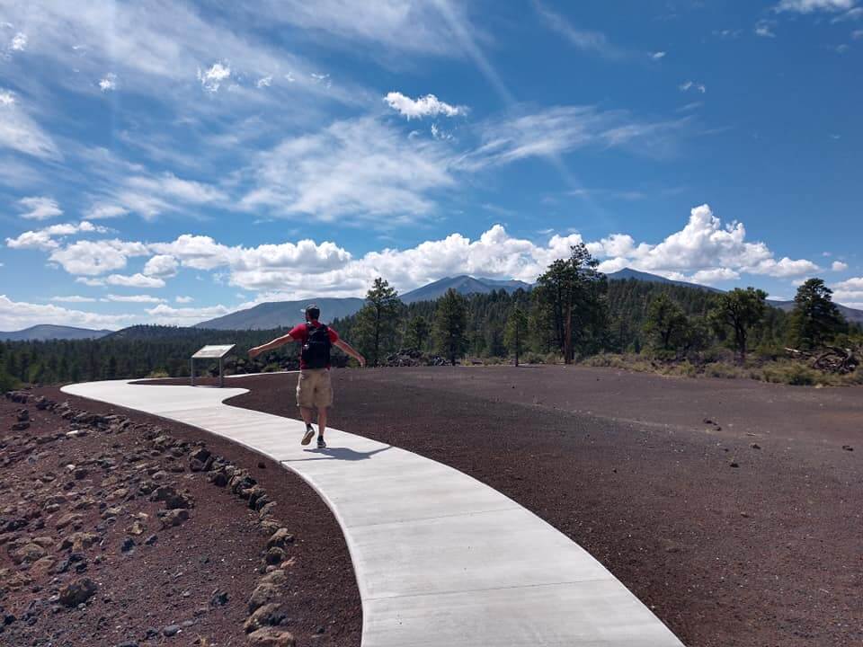
3. Sunset Crater
Sunset Crater is just one of the 600 volcanos that make up the San Francisco Peaks. According to the National Parks Service, Sunset Crater last erupted in 1085. Taking the Lava Flow Trailhead will lead you to the base of Sunset Crater. (listed below)
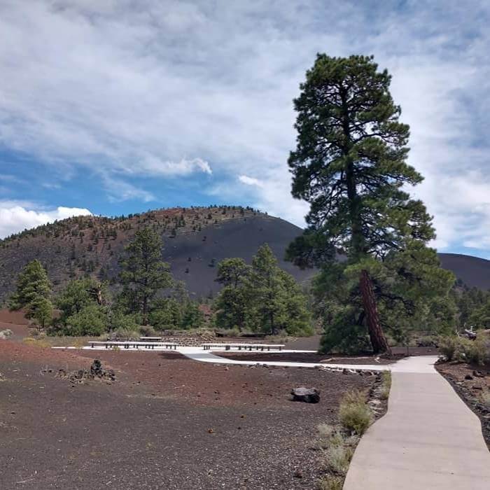
4. Lava Flow Trailhead

The Lava Flow Trail will take you on a .8 mile hike from the parking lot to the base of Sunset Crater. There were a few stairs during the hike but seemed to be fairly easy.
Unfortunately, access to the top was closed in 1973. If you would like to hike to the top of a crater then go to the Lenox Trailhead next door.
5. Lenox Trailhead
The Lenox trail is about 1 mile to the top, and you will be rewarded with a 360 view. The trail is all uphill but has trees to shade you along the way.
Erosion has taken over, so you won’t see the big crater when you get to the top. It’s more like a dome at the top with a very small indention where the crater used to be.
6. Wupatki National Monument
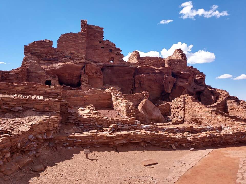
The Wupatki National Monument displays pretty cool Native American ruins. This sort of settlement was called a Pueblo. If you would like to read a little more about this particular settlement you can visit NationalParks.org or NPS.org.

The visitors center is now open, check out the website before going because they often have closures due to fire danger.
We spent almost 2 hours checking everything out and reading plaques. (what can I say, we are nerds sometimes). It was SUPER hot, so bring those water bottles, and make sure you stand over that ancient ac unit in the ground.
7. Cinder Hills OHV Area
When we were driving along the loop trail we noticed some side-by-sides climbing the sandy dunes.
I thought to myself holy CRAP that looks awesome. Well, it turns out you can bring your own vehicle to Cinder Hills, where there are several mountains and areas you can climb.
On the maps (in the link above), you can see this area is below the loop trail.
If you are interested in finding more volcanos in the USA read these posts next.
