Last Updated on June 2, 2024 by Nikole
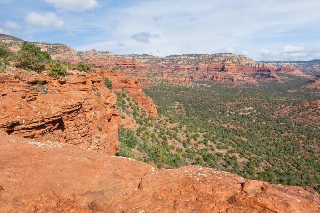
Sedona, Arizona is a hiker’s paradise, with its stunning red rock landscapes, unique rock formations, and diverse trails that cater to hikers of all levels.
Whether you’re a beginner looking for a leisurely stroll or an experienced hiker seeking a challenging trek, Sedona has something for everyone.
Here are the best 17 hiking trails in and near Sedona (which we have also mapped out for you on Google), each offering its own breathtaking views and natural wonders.
1. Boynton Canyon Trail and Subway Cave

The Boynton Canyon Trail is a 6.1-mile out-and-back trail that offers stunning views of the red rock formations and lush vegetation. The highlight of this trail is the Subway Cave, a narrow passage between two towering rock walls that provides a unique and memorable hiking experience.

Length: 6.1 miles
Distance from Sedona: 3 miles
Location: Boynton Canyon Road, Sedona, AZ
Ease of Use: Moderate
Trail Type: Out and back
2. Cathedral Rock Trail

Cathedral Rock Trail is a short but challenging 1.2-mile out-and-back trail that rewards hikers with panoramic views of the surrounding red rock formations and the city of Sedona below.

The trail features steep inclines and rock scrambling, making it ideal for experienced hikers looking for a thrilling adventure.

Length: 1.2 miles
Distance from Sedona: 4 miles
Location: Back O’ Beyond Road, Sedona, AZ
Ease of Use: Moderate to Difficult
Trail Type: Out and back
3. Courthouse Butte and Bell Rock Loop Trail

This 4.2-mile loop trail allows hikers to explore two iconic red rock formations, Courthouse Butte and Bell Rock. The trail provides breathtaking views of the surrounding landscape and is an easy flat hike that is suitable for beginners.
You may need a Red Rock Pass to hike here.
Length: 4.2 miles
Distance from Sedona: 6 miles
Location: Arizona 86351
Ease of Use: Easy to Moderate
Trail Type: Loop
4. Pyramid to Scorpion Trail Loop
The Pyramid to Scorpion Trail Loop is a 3.6-mile loop trail that takes hikers through diverse terrain, including rocky outcrops and scenic overlooks.
The trail offers stunning views of the red rock formations and is perfect for hikers seeking a moderately challenging adventure.
Length: 3.6 miles
Distance from Sedona: 7 miles
Location: Arizona 86336
Ease of Use: Moderate
Trail Type: Loop
5. Birthing Cave Trail
The Birthing Cave Trail is a 2.4-mile out-and-back trail that leads to a natural rock formation resembling a pregnant woman lying on her back.
Length: 2.4 miles
Distance from Sedona: 8 miles
Location: Deadman’s Pass Trail, Sedona, AZ 86336
Ease of Use: Easy
Trail Type: Out and back
6. Airport Loop Trail
The Airport Loop Trail is a 3.3-mile loop trail with a super rocky path offering panoramic views of the surrounding red rock formations. This loop trail loops around the upper slope of Airport Mesa, also known as Table Top Mountain.
Length: 3.3 miles
Distance from Sedona: 1 mile
Location: Airport Road, Sedona, AZ
Ease of Use: Easy
Trail Type: Loop
7. Devil’s Bridge Trail

Devil’s Bridge Trail is a popular 4.2-mile out-and-back trail that leads to an iconic natural sandstone arch known as Devil’s Bridge.
You can hike or drive a 4×4. If you drive a 4×4 your trip will only be about 2 miles long.
Length: 4.2 miles
Distance from Sedona: 8 miles
Location: Dry Creek Road, Sedona, AZ
Ease of Use: Moderate
Trail Type: Out and back
8. Seven Sacred Pools

The Seven Sacred Pools trail is a 1-mile out and back trail that leads to a series of natural pools formed by Oak Creek.

The trail offers a peaceful and scenic hike, with opportunities to relax by the pools and take in the beauty of the area.
Length: 1 mile
Distance from Sedona: 12 miles
Location: Midgley Bridge, Sedona, AZ
Ease of Use: Easy
Trail Type: Out and back
9. Munds Wagon Trail to Merry Go Around Rock

The Munds Wagon Trail to Merry Go Around Rock is a 5.4-mile out-and-back trail that offers stunning views of the red rock formations and the surrounding landscape.
The highlight of the trail is the Merry Go Around Rock, a unique rock formation that provides a great spot for taking in the scenery.
Length: 5.4 miles
Distance from Sedona: 5 miles
Location: Schnebly Hill Road, Sedona, AZ
Ease of Use: Moderate
Trail Type: Out and back
10. Bear Mountain Trail

Bear Mountain Trail is a challenging 4.6-mile out-and-back trail that leads to the summit of Bear Mountain, offering panoramic views of Sedona and the surrounding red rock formations.
The trail features steep inclines and rocky terrain, making it suitable for experienced hikers seeking a rewarding challenge.
Length: 4.6 miles
Distance from Sedona: 7 miles
Location: Doe Mountain Trailhead, Sedona, AZ
Ease of Use: Difficult
Trail Type: Out and back
11. Hangover Trail
The Hangover Trail is a difficult 8.6-mile out-and-back trail that offers breathtaking views of the red rock formations and surrounding canyons.
The trail features steep inclines and rocky terrain, providing a thrilling adventure for experienced hikers.
Even though the path is strenuous there are many treats along the way including, gorgeous views, bouldering, and climbing opportunities. At some points you may be climbing on the side of the red rock formations.
Length: 8.6 miles
Distance from Sedona: 9 miles
Location: Schnebly Hill Road, Sedona, AZ
Ease of Use: Difficult
Trail Type: Out and back
12. Fay Canyon Arch Trail

Fay Canyon Arch Trail is a moderate 2.4-mile out-and-back trail that leads to a natural sandstone arch with stunning views of the canyon below.

The trail starts at a parking lot just off Boynton Pass Road, and you will follow signs for Fay Canyon Trailhead.
Length: 2.4 miles
Distance from Sedona: 5 miles
Location: Boynton Pass Road, Sedona, AZ
Ease of Use: Moderate
Trail Type: Out and back
13. Brins Mesa Via Brins Ridge Trail

The Brins Mesa Via Brins Ridge Trail is a 6.1-mile loop trail that offers panoramic views of the red rock formations and surrounding canyons. The trail features a few formations including the Sphinx and the Devil’s kitchen.
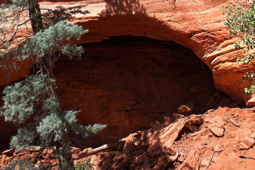
You can start at one of three entrances. Soldiers Pass has a small parking area but will showcase some pretty interesting cave formations. You can also try the Brins Mesa Parking area, however, if you take this route your journey will be significantly longer.
The last entrance is Jordan Road Trailhead where you will find a beautiful view right from the parking lot.
Length: 6.1 miles
Distance from Sedona: 5 miles
Location: Jordan Road Trailhead, Sedona, AZ
Ease of Use: Moderate
Trail Type: Loop
14. Walnut Canyon Island Trail
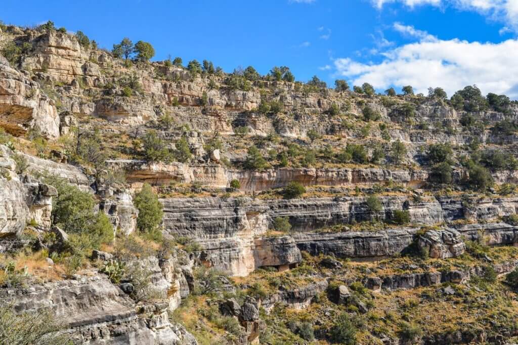
The Walnut Canyon Island Trail is a short but scenic 0.7-mile loop trail that takes hikers through a narrow canyon with towering rock walls.
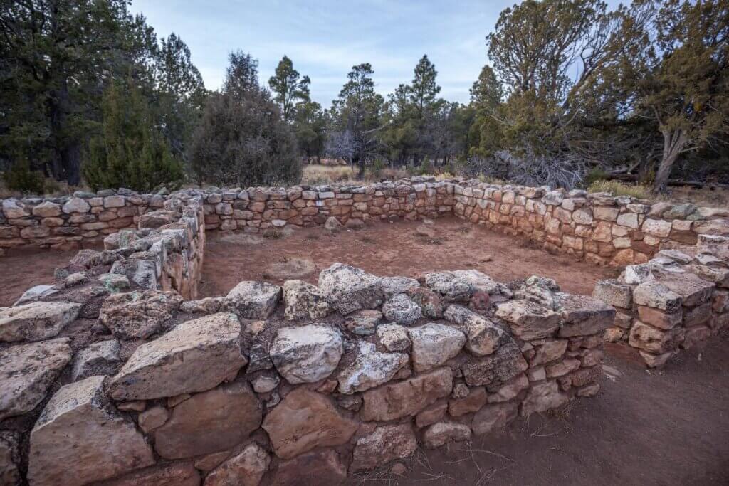
The area used to be inhabited by the native people, of Sinagua. You can see 25 dwellings along the cliffside that these people built.
Be prepared for a strenuous hike, even though it’s paved you will find numerous stairs that lead you up an incline of 7,000′ elevation.
Length: 0.7 miles
Distance from Sedona: 12 miles
Location: Walnut Canyon, Sedona, AZ
Ease of Use: Easy
Trail Type: Loop
15. Snoopy Rock

Snoopy Rock is an iconic rock formation visible from various vantage points in Sedona.
While there isn’t a designated trail to Snoopy Rock, visitors can enjoy views of this famous formation from several viewpoints around town.
Distance from Sedona: Varies based on viewpoint location
Location: Various viewpoints around Sedona, AZ
16. Doe Mountain

Doe Mountain is a moderate 1.4-mile out-and-back trail that leads to the summit of Doe Mountain, offering panoramic views of the surrounding red rock formations and canyons below.
Length: 1.4 miles
Distance from Sedona: 3 miles
Location: Boynton Pass Road, Sedona, AZ
Ease of Use: Moderate
Trail Type: Out and back
17. West Fork, Oak Creek Canyon

West Fork is a popular hiking trail located in Oak Creek Canyon, just north of Sedona. This scenic trail follows the creek through lush vegetation and towering canyon walls.

You may find a few creek crossings where you will have to get your feet wet, but hey that’s all part of this immersive experience.

Also, remember that the first 3 miles of this trail are well-maintained and marked, but the rest is not.
Length: 6.9 miles (round trip)
Distance from Sedona: 10 miles
Location: Oak Creek Canyon, Sedona, AZ
Ease of Use: Easy to Moderate
Trail Type: Out and back
In Conclusion
From leisurely strolls to challenging treks, the hiking trails in and near Sedona offer something for every outdoor enthusiast. Whether you’re drawn to panoramic vistas, unique rock formations, or serene natural settings, these trails showcase the diverse beauty of the Arizona landscape.